Building a Reliable Satellite Communication Network for Remote Expeditions

How much would you pay to ensure a single SOS signal actually reaches a rescue coordination center when you are 40 miles from the nearest trailhead? Most adventurers view satellite communication as a "set and forget" insurance policy, but in high-stakes environments like the North Cascades or the remote stretches of the High Sierra, a single point of failure in your communication stack can be the difference between a controlled extraction and a catastrophe. Building a reliable network requires moving beyond the consumer-grade mindset and treating your connectivity as a redundant, multi-layered system.
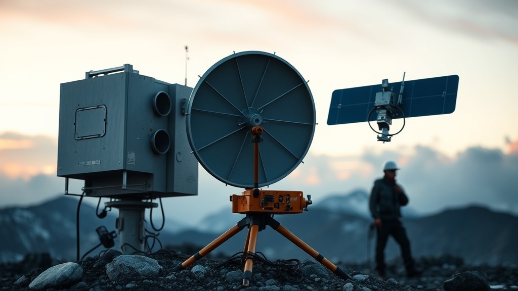
The Three Pillars of Satellite Redundancy
A reliable network is not defined by a single expensive device, but by the interplay between three distinct layers: the Primary Messenger, the Emergency Beacon, and the Redundant Receiver. Relying solely on a single device—even a high-end one—is a tactical error. If a device suffers a lithium-ion failure or a hardware malfunction due to extreme cold, your ability to signal for help vanishes.
To calculate the true value of your kit, look at the cost-per-mile of reliability. A $400 device that fails once every 500 miles is significantly more expensive than a $350 device that maintains a 99.9% uptime over 5,000 miles. When building your stack, prioritize hardware that utilizes different orbital constellations to ensure that even if one network is experiencing latency, another remains operational.
Layer 1: The Primary Messenger (Two-Way Communication)
The primary messenger is your tool for non-emergency logistics: updating family on arrival times, checking weather updates, or coordinating with a ground team. This layer requires a device capable of sending and receiving text-based data. The current industry standard for this layer includes devices like the Garmin inReach Mini 2 or the Zoleo Satellite Communicator.
- Garmin inReach Mini 2: This device is highly effective because it utilizes the Iridium Satellite Network. Iridium is a Low Earth Orbit (LEO) constellation, which is critical for providing global coverage, including the polar regions. The Mini 2 is particularly robust for high-movement activities like technical climbing where a compact form factor is mandatory.
- Zoleo: This device excels in its ability to bridge the gap between satellite and cellular. It provides a dedicated SMS number, which simplifies the user experience for those receiving messages from terrestrial networks. It is an excellent choice for long-haul expeditions where you transition frequently between high-altitude zones and valley floors with intermittent cellular access.
When selecting your primary messenger, check the subscription model's flexibility. A rigid, annual contract is a liability if your expedition dates shift. Look for "Freedom" or "On-Demand" plans that allow you to suspend service when you are not in the field. This reduces your long-term cost-per-mile by ensuring you aren't paying for connectivity while sitting at your desk.
Layer 2: The Emergency Beacon (The Last Resort)
The second layer must be an Emergency Position Indicating Radio Beacon (EPIRB) or a Personal Locator Beacon (PLB). Unlike the messengers mentioned above, which rely on proprietary satellite networks and data-heavy protocols, a PLB communicates directly with the COSPAS-SARSAT international satellite system. This is a government-funded, high-power network designed for one purpose: life-saving distress signals.
A PLB, such as the ACR ResQLink, transmits a much stronger signal than a handheld satellite messenger. While an inReach might struggle to punch through heavy canopy or deep canyon walls in places like the Zion backcountry, a PLB’s 5-watt transmitter is designed to pierce through environmental interference. This device should be kept in a dedicated, easily accessible location—never inside a pack that is currently being climbed or submerged in a river.
"The fundamental mistake in expedition planning is assuming that a device that 'can' send an SOS is a device that 'will' send an SOS. A messenger is a communication tool; a PLB is a survival tool. They are not interchangeable."
Layer 3: The Redundant Receiver and Power Management
A communication network is useless if the hardware lacks the energy to transmit. In remote environments, power is your most constrained resource. Your third layer consists of the hardware required to keep the previous two layers operational. This involves high-capacity power banks and, if you are on multi-week expeditions, portable solar arrays.
To maintain a functional network, you must manage the power draw of your devices meticulously. For instance, an inReach device consumes significantly more power when it is constantly polling for a GPS lock. To extend your device's life, configure it to transmit updates at longer intervals—perhaps every 4 hours instead of every 30 minutes—unless an emergency is active. This is a critical component of optimizing your device's battery life for low-signal areas and ensuring it remains functional through the duration of your trip.
Technical Implementation: The Deployment Protocol
Having the gear is only half the battle; the way you deploy it determines its effectiveness. Follow these specific protocols to ensure your network remains robust during an expedition.
- The "Clear Sky" Rule: Satellite communication requires a line of sight to the sky. When setting up a base camp or a long-term bivouac, place your primary messenger on a flat, unobstructed surface. Avoid placing it under heavy tree cover or near large rock faces, which can cause signal attenuation.
- The Altitude Gradient: If you are moving through a steep valley, such as the Yosemite backcountry, your signal may be blocked by the canyon walls. Always check your device's "satellite view" or "sky view" before deciding on a rest spot. A higher elevation, even if it is less comfortable, provides a much higher probability of a successful transmission.
- The Battery Buffer: Never let your primary communication device drop below 20% charge. In extreme cold, such as a winter trek in the White Mountains, lithium-ion batteries discharge much faster. Keep your devices in an inner clothing pocket, close to your body heat, to prevent voltage drops and unexpected shutdowns.
Evaluating the Value: Cost-Per-Mile vs. Price Tag
When building this network, do not be swayed by the lower entry price of consumer-grade gadgets. A cheap, unproven device that fails during a storm in the Patagonian wilderness has an infinite cost. To truly evaluate your kit, use a simple formula: (Total Cost of Hardware + Annual Subscription) / Total Miles Planned.
If you are planning a 500-mile thru-hike, a $500 Garmin setup with a $150 annual fee results in a cost of $1.30 per mile. If you opt for a cheaper, less reliable device that requires frequent replacement or fails during the trip, your cost-per-mile effectively becomes astronomical. Invest in the hardware that offers the highest degree of redundancy and the most established satellite constellation. A robust network is an investment in your ability to return home, not just another piece of tech in your pack.
By integrating a high-frequency messenger, a high-power PLB, and a disciplined power management strategy, you move from "hoping for a signal" to "commanding a network." This is the standard required for any serious remote expedition.
Steps
- 1
Register Your Device and Subscription
- 2
Configure Emergency Contact Protocols
- 3
Test Signal Strength in Open Terrain
- 4
Sync with Mobile Apps for Offline Mapping